Urban Adaptation in Brooklyn, NY
Urbanism Core IV Studio, Spring 2021
Instructor: Aniket Shahane
(Collaboration with Joshua Tan and Brandon Brooks)
Urbanism Core IV Studio, Spring 2021
Instructor: Aniket Shahane
(Collaboration with Joshua Tan and Brandon Brooks)
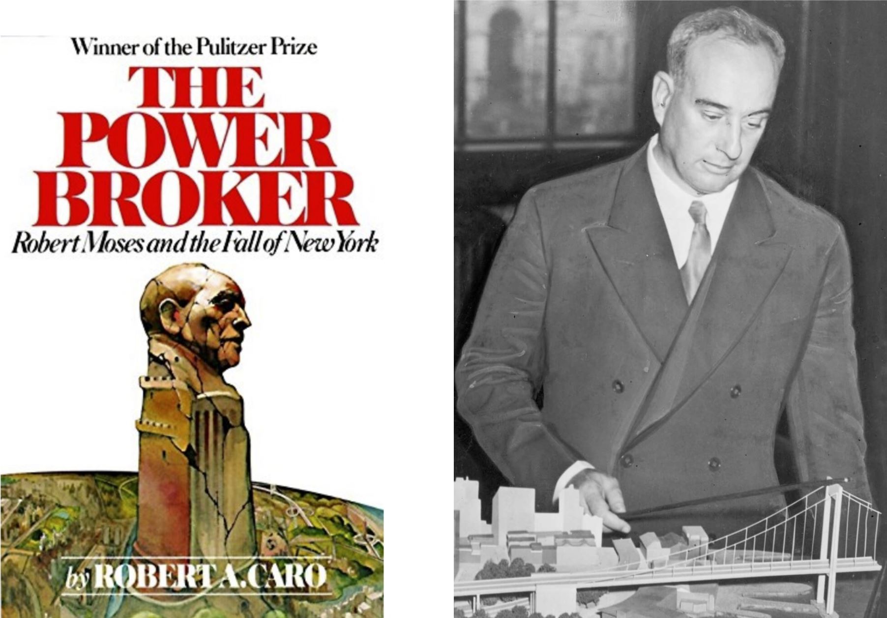
“Once the (third) avenue had been a place for people; Robert Moses had made it a place for cars. And as the avenue’s roadway became more crowded, its sidewalks began to empty…
With its heart gone, the neighborhood had no will to resist the invasion. There was nothing to hold its people… The whole area died with the road.” (523-524)
- Robert A. Caro, The Power Broker
Throughout the history of D15, we have witnessed an entanglement between education and transportation, which has generated systems of physical and implied boundaries, isolating neighborhoods, disconnected communities like Red Hook and Sunset Park, and contributing to an inhospitable streetscape for school kids.
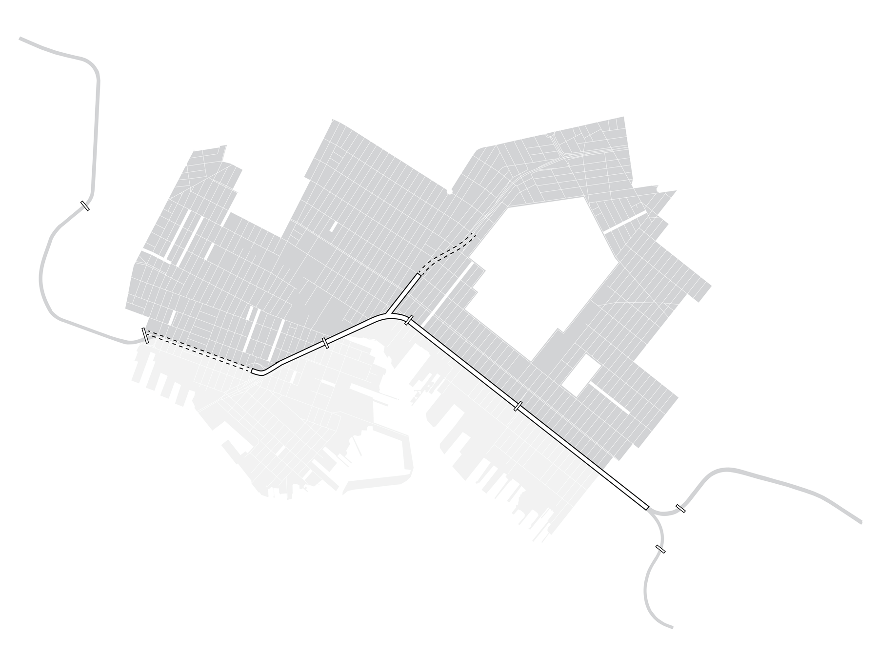
Our project, Healing through Adaptation, aims to heal the division in District 15 neighborhoods by adapting the existing Brooklyn Expressway and proposing an alternative transit system.
Our project, Healing through Adaptation, aims to heal the division in District 15 neighborhoods by adapting the existing Brooklyn Expressway and proposing an alternative transit system.

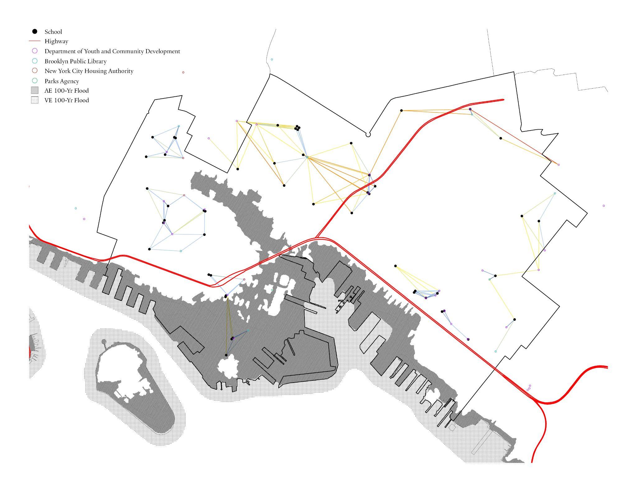

Our research also indicates how the neighborhood has long be divided and separated by the physical presence of the elevated expressway, and how existing transit systems can hardly accomodate the need for school chridren to navigate the district - a student from Sunset Park Prep needs to transfer as many as three times to arrive at another “education resource cluster” in Cobble Hill.
Three players...
Children
Educational Resources
Adults
Daily Commute & Spontaneous Activities
Freights
Scaler Handoff of Distribution
Children
Educational ResourcesAdults
Daily Commute & Spontaneous ActivitiesFreights
Scaler Handoff of Distribution
Three focuses of Intervention...
Phasing Plan
Long-term effects of Adapting the BQE
Adapting the Streets
A multi-purpose human-friendly transit system
The Pod
Flexible Transportation and Education Space
Phasing Plan
Long-term effects of Adapting the BQEAdapting the Streets
A multi-purpose human-friendly transit systemThe Pod
Flexible Transportation and Education SpaceThree times in a day...
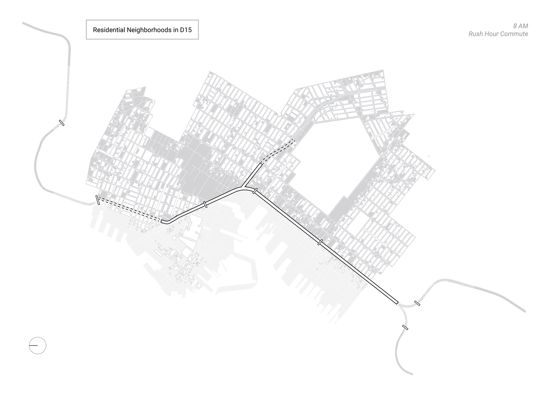
8 am
Residential <-> commercial; rush hour commute
3 pm
Cluster <-> cluster; linking education resources
8 pm
Industrial <-> commercial; freight scaler handoff
8 am
Residential <-> commercial; rush hour commute3 pm
Cluster <-> cluster; linking education resources8 pm
Industrial <-> commercial; freight scaler handoff
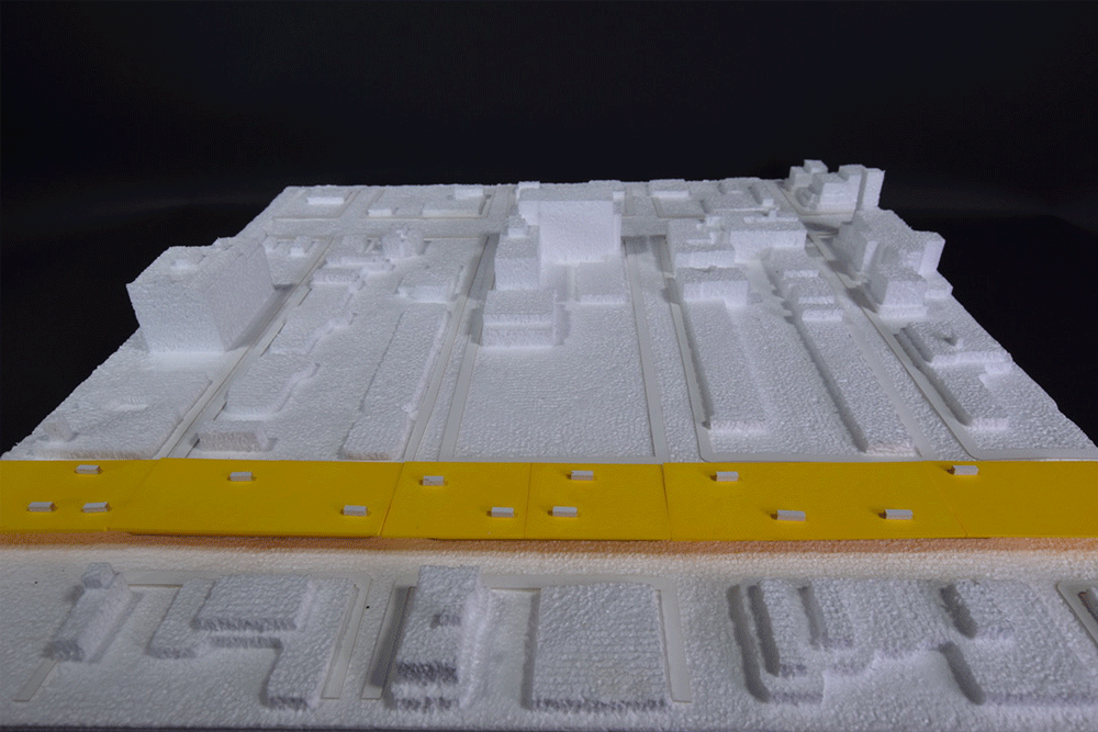
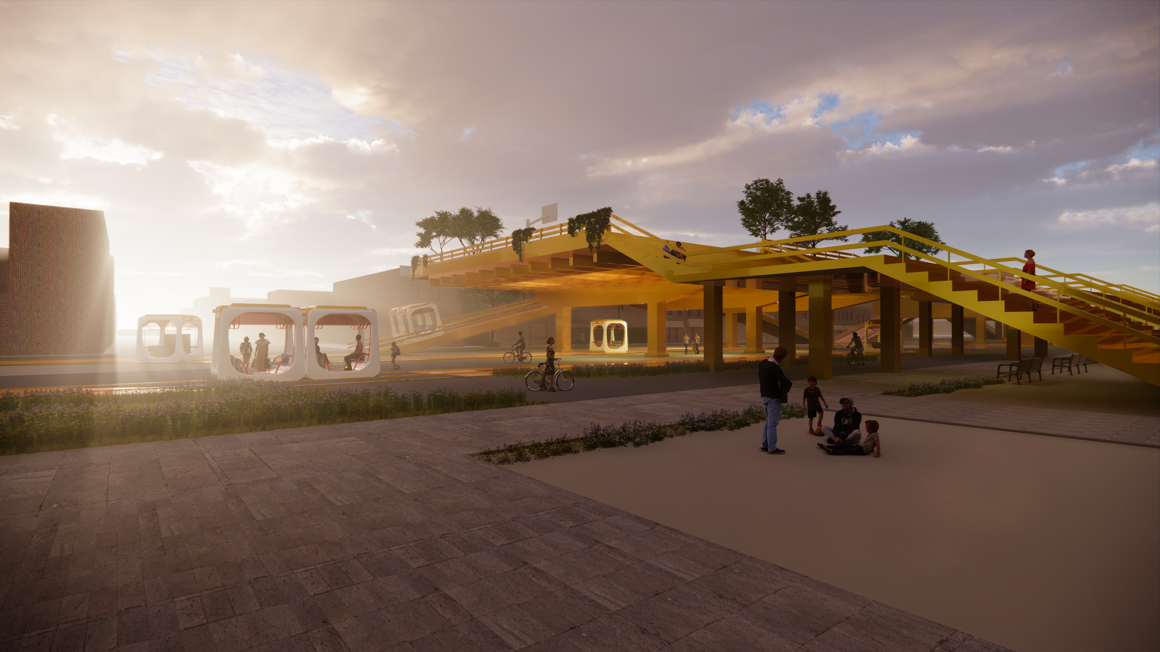
↑ Phasing Out the BQE

On the street level, the actions that we eliminates the overhead presence of the BQE, giving the streets back to the residents of D15, the proposed plan also taps into the open streets in Brooklyn show here, strengthening the east-west fabric of the city.

Looking at the proposed track system and the new relationship formed between the leftover BQE chunks and the streets, with no cars in the city, the streets are given to these human-friendly tracks that are interwoven together. From left to right in this plan, it shows slow and fast walking lanes, bioswale, tracks for transit pods, and open space for spontaneous activities.
In the long run, adjacent buildings can be connected through this for expansion of programs.
In the long run, adjacent buildings can be connected through this for expansion of programs.
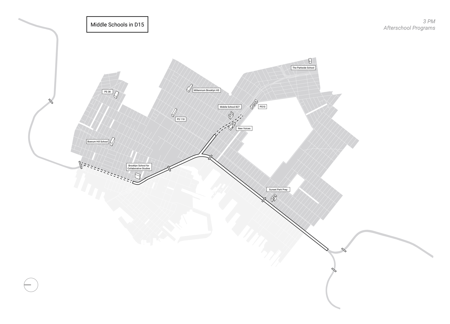


The expressway chunk shown above serves as an extension to the exitsting playground of Sunset Park Prep. This adapted expressway chunk not only provides extra activity spaces, but also connects the streets east west so that the students can get to the other side safer and quicker.
Other alternative afterschool programs including community farm and outdoor classrooms can also happen on these expressway extensions.
Other alternative afterschool programs including community farm and outdoor classrooms can also happen on these expressway extensions.
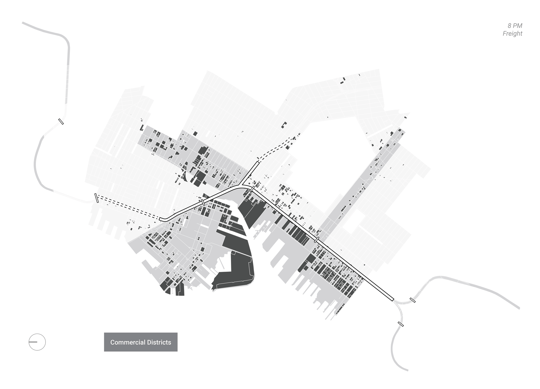


At night, the transit system takes on delivery duty by linking waterway delivery and industrial production to the individuals in D15. The pods also help breaking down the volume of the freight in this process.
The BQE chunks that serve as transit hubs are intended for multi-purpose uses, for example, the top deck features charging ports, distribution stations, and parking stations that can serve as temporary spontaneous event spaces(food truck etc.).
The BQE chunks that serve as transit hubs are intended for multi-purpose uses, for example, the top deck features charging ports, distribution stations, and parking stations that can serve as temporary spontaneous event spaces(food truck etc.).